
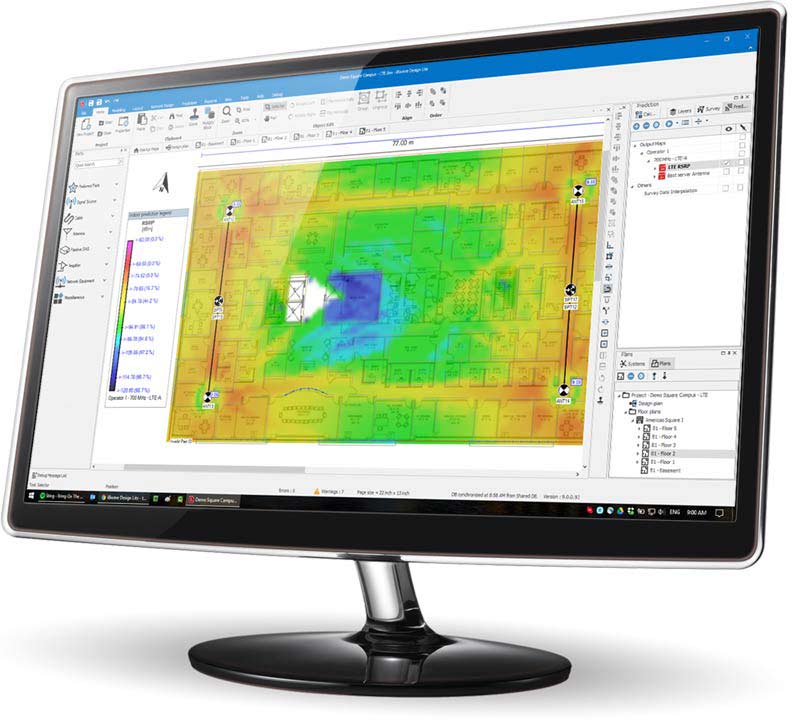
Uplink Output Maps Are Revolutionizing Public Safety Network Design
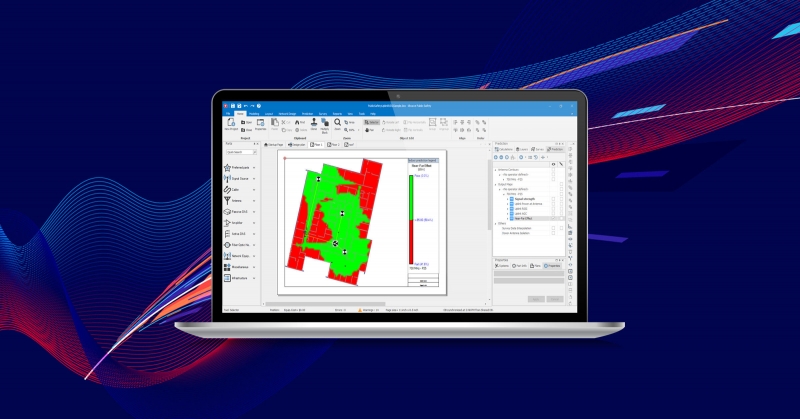
In today's digital era, ensuring public safety is of paramount importance. Emergency response teams and public safety organizations rely heavily on robust and reliable network infrastructure to effectively carry out their operations. This is where iBwave, a leading provider of cutting-edge wireless network design solutions, comes into play. With their innovative technology, iBwave is revolutionizing public safety network design by introducing new uplink output maps, which streamline the entire process and empower organizations to create efficient and resilient networks tailored to their specific needs.
The new maps added to iBwave Public Safety are:
Uplink RSSI Maps
Automatic Gain Control (AGC) Maps
Near Far Effect Maps
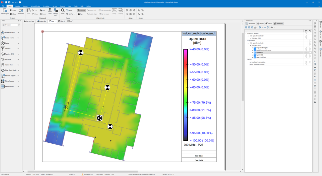
Uplink RSSI Maps: Visualizing Signal Quality and Coverage for Effective Communication
In Public Safety Distributed Antenna Systems (DAS), the uplink Received Signal Strength Indicator (RSSI) plays a critical role in ensuring seamless and reliable communication for first responders and emergency services. Uplink RSSI refers to the measurement of signal strength received from user devices, such as radios or mobile phones, at the Public Safety BTS site.
Uplink RSSI levels are paramount in maintaining consistent coverage and minimizing signal interference.
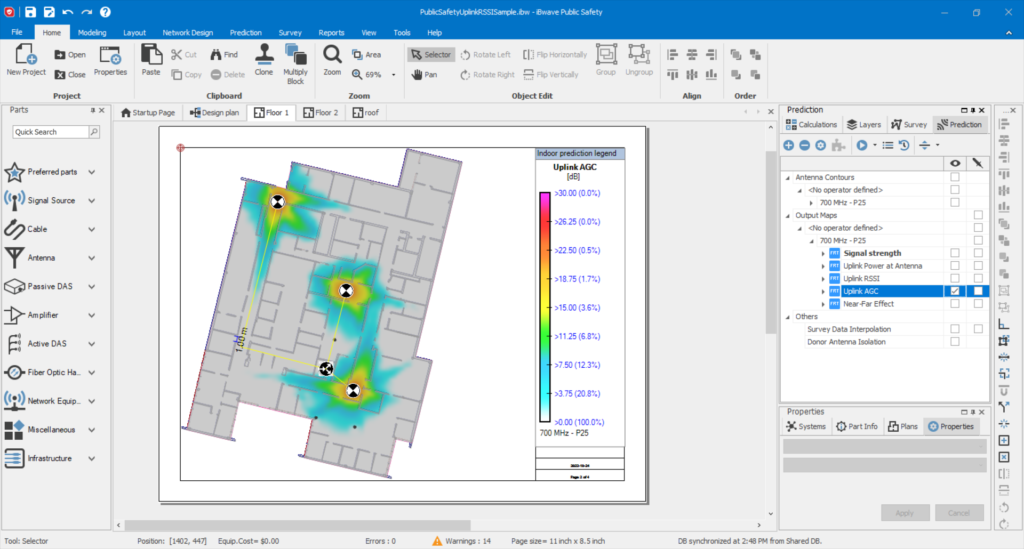
Automatic Gain Control (AGC) Maps: Optimizing Signal Strength for Resilient Networks
AGC (Automatic Gain Control) maps, generated using iBwave's advanced software, provide valuable insights into signal strength variations within a given area. These maps highlight areas where signal strength might fluctuate due to environmental factors, building materials, or obstructions. By analyzing AGC maps, public safety organizations can identify weak signal areas or potential coverage gaps, allowing them to optimize their network design and ensure reliable communications throughout the coverage area.
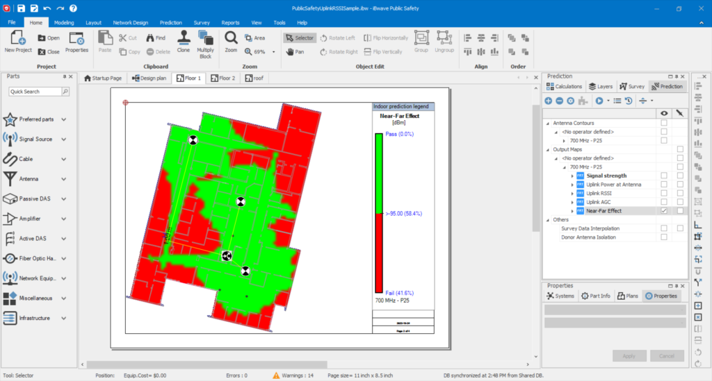
Near Far Effect Maps: Minimizing Signal Interference for Seamless Connectivity
The primary concern in Public Safety DAS is the Near Far Effect, which can lead to radio communication issues when crucially needed. This effect occurs when a portable radio is activated near an indoor antenna while another portable radio is simultaneously activated at a distance far from the antenna. The close radio transmission compels the BDA (Broadband) device to reduce its gain to avoid saturation or overload, potentially resulting in an insufficient gain for reliable communication back to the donor site for the radio positioned far from the antenna. To overcome this issue, iBwave has created this plot so you can visually see the area of issues.
Tailored Solutions: Customizing Maps to Meet Specific Needs
iBwave's commitment to delivering tailored solutions extends to Uplink RSSI, AGC, and Near Far Effect maps. Their software allows organizations to customize these maps according to their specific requirements, taking into account factors such as frequency bands, equipment types, and network protocols. By providing this level of flexibility, iBwave ensures that public safety organizations can design networks that perfectly align with their operational needs, ultimately enhancing their effectiveness in critical situations.
Transforming Public Safety Network Design with iBwave's Uplink Maps
In conclusion, iBwave is revolutionizing public safety network design with its innovative Uplink RSSI, AGC and Near Far Effect maps. By providing a comprehensive visual representation of network performance, these maps empower organizations to optimize coverage, improve situational awareness, and enhance their emergency response capabilities. With iBwave's cutting-edge technology, public safety organizations can confidently design robust and resilient networks that ensure uninterrupted communications when they matter the most. Experience the power of iBwave's AGC, RSSI, and Near Far Effect maps and streamline your public safety network design.
Learn more about iBwave’s solutions for Public Safety network surveys and designs!